pycoast
  • Installation
  • Usage
  • High quality contours using AGG
  • Adding graticule to images
  • Pycoast from a configuration file
  • Custom shapes and lines
  • Add custom points with descriptions
  • Shapes from ESRI shape files
  • Testing
  • PyCoast API
pycoast
  • Pycoast
  • View page source

Pycoast

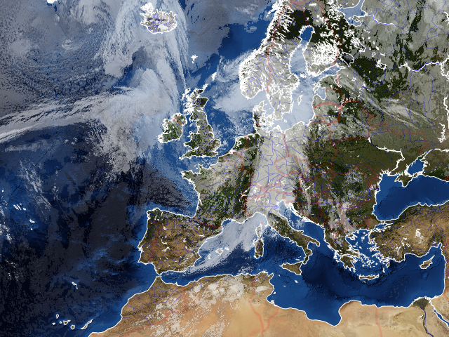
Pycoast is a Python package to add coastlines, borders and rivers to raster images using data from the GSHHS and WDBII datasets

_images/euro_coast_agg.png
  • Installation
    • Package installation
    • Installation of shape files
    • Installation of city names
  • Usage
    • Example with tuple
    • Example with AreaDefinition
  • High quality contours using AGG
  • Adding graticule to images
  • Pycoast from a configuration file
  • Custom shapes and lines
  • Add custom points with descriptions
  • Shapes from ESRI shape files
    • Reproject unsupported shapefiles
    • Complex shape drawing
  • Testing
  • PyCoast API
    • pycoast package
Next

© Copyright 2012, Esben S. Nielsen.

Built with Sphinx using a theme provided by Read the Docs.